StreetAware: A High-Resolution Synchronized Multimodal Urban Scene Dataset
Creators

-
1.
 New York University
- 2. NEC Laboratories America
Description
Access to high-quality data is an important barrier in the digital analysis of urban settings, including applications within computer vision and urban design. Diverse forms of data collected from sensors at areas of high activity in the urban environment, such as street intersections, are thus a valuable resource for researchers interpreting the dynamics between vehicles, pedestrians, and the built environment. We present a high-resolution audio, video, and LiDAR dataset of three urban intersections in Brooklyn, New York, totaling approximately 8 unique hours. The data is collected with custom Reconfigurable Environmental Intelligence Platform (REIP) sensors that are designed with the ability to accurately synchronize multiple video and audio inputs.
Access Information
Due to the size (~550 GB) and complexity of the data, you must access it via Globus: https://app.globus.org/file-manager?origin_id=c43d41ac-d286-4ac4-9318-3d65f3d9b855&origin_path=%2Fq1byv-qc065-streetaware%2F. The README file explains the contents further.
Files
park_map.pdf
Files
(3.4 MB)
| Name | Size | Download all |
|---|---|---|
|
chase_map.pdf
md5:3afd3c08f245194b097181fcb07a163f
|
1.3 MB | Preview Download |
|
dumbo_map.pdf
md5:27692de72b851bf66e640d6df1722bcd
|
632.3 kB | Preview Download |
|
park_map.pdf
md5:a0231b8607619b86836b5bff67037379
|
612.8 kB | Preview Download |
|
README.md
md5:9601b708da26c9f5c7eb94373e4f3755
|
4.4 kB | Preview Download |
|
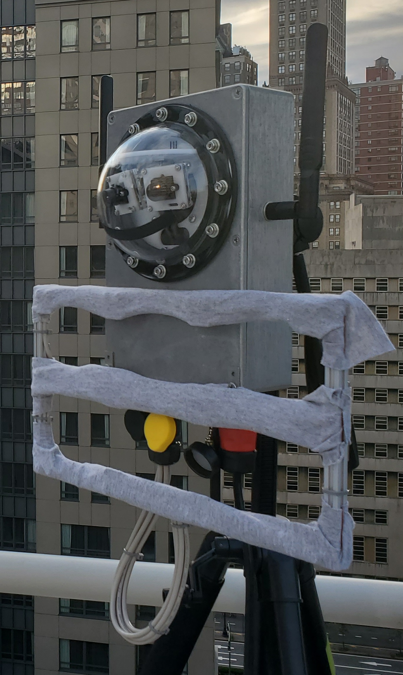
reip_sensor.jpg
md5:60d41cd593802ef4a78acc4b5ab45381
|
810.6 kB | Preview Download |
Additional details
Related works
- Is cited by
- Journal article: 10.1016/j.compenvurbsys.2023.101950 (DOI)
- Is required by
- Software: https://github.com/reip-project/street-aware (URL)
- Is reviewed by
- Other: https://nyudatascience.medium.com/using-computer-vision-to-improve-sidewalk-maps-353e13e5fa19 (URL)
Funding
Dates
- Created
-
2022-08Data collection month.